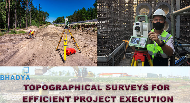
At Bhadya Engineering Services, we offer top-notch topographical survey solutions to provide accurate and detailed information about the terrain and features of your project site. Our team of experienced surveyors utilizes state-of-the-art equipment and advanced techniques to capture precise measurements and create comprehensive topographical maps and models.
Key aspects of our topographical survey services include:
Data Collection:
Our skilled surveyors employ a combination of ground-based surveying equipment, aerial drones, and satellite positioning systems to collect data points and measurements across the project site. We capture information about elevation, contours, existing structures, vegetation, water bodies, and other relevant features.
Accurate Mapping:
Using the collected data, we create high-quality topographical maps that depict the terrain in detail. These maps provide valuable information about the site's elevation changes, slope gradients, and natural or artificial features. The accuracy of our mapping ensures that you have precise and reliable data for your project planning and design.
Three-Dimensional Modeling:
In addition to traditional topographical maps, we can generate three-dimensional (3D) models of the site. These models offer a realistic visualization of the terrain, allowing you to analyze and understand the spatial relationships between different elements of the landscape.
Data Analysis and Integration:
We not only capture the topographical data but also analyze it to derive valuable insights. Our team can integrate the topographical data with other geospatial information or Geographic Information Systems (GIS) databases, enabling you to make informed decisions and enhance the efficiency of your project.
Project Applications:
Our topographical survey services find applications across various industries and projects. Whether it's urban planning, infrastructure development, construction projects, environmental assessments, or land management, our accurate topographical data provides a solid foundation for decision-making and design processes.
By choosing Bhadya Engineering Services for your topographical survey needs, you can expect meticulous attention to detail, precise data collection, and reliable results. We prioritize delivering high-quality and actionable information to support your project requirements and objectives.
Contact us today to discuss your topographical survey needs, and let us assist you in gaining a comprehensive understanding of the terrain and features of your project site.
